 Base maps : Portugal 2010
|

|
All Portugal, by Regions
Territorial division 2010
Layers : Parishes(Freguesias), Communes (Municípios), NUTS2, NUTS3
Fonte : Geography Institute of Portugal,
IGEO -
Municipal digital mesh :
IGEO
Licence to use |
-

|

|
All download files are compressed in .zip format.
They must be unzipped before any use.
Click on a red button to download the file... |
|
| |
|
|
| Portugal,
Regions |
|
|

|
Portugal (all) |
|
|
Portugal (continental) |
|
|
11. North |
|
|
15. Algarve |
|
|
16. Center |
|
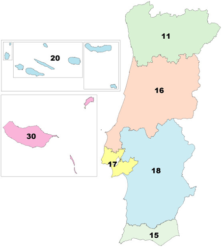 |
| 17. Lisabon |
|
| 18. Alentejo |
|
| 20. Açores |
|
| 30. Madeira |
|
| Commune of
Lisabon |
|
|
These base maps are intended to represent statistical data and only
for that.
No guarantee is given concerning the precision of the contours of
the statistical and administrative entities, the location of the
towns,
scale, international borders, etc. You are not authorized to
redistribute copies of the downloadable files on this page. |
Ícones das Bandeiras :
http://www.icondrawer.com/